Dosiero:Rhus typhina range map 4.png
Salti al navigilo
Salti al serĉilo

Grandeco de ĉi antaŭvido: 799 × 599 rastrumeroj. Aliaj distingivoj: 320 × 240 rastrumeroj | 640 × 480 rastrumeroj | 1 024 × 768 rastrumeroj | 1 280 × 960 rastrumeroj | 2 560 × 1 920 rastrumeroj | 3 854 × 2 891 rastrumeroj.
Fonta dosiero (3 854 × 2 891 rastrumeroj, dosiera grandeco: 243 KB, MIME-tipo: image/png)
Resumo
| Priskribo |
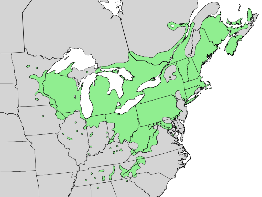
English: Range map of Rhus typhina — native to the Eastern U.S. |
| Dato | |
| Fonto | Digital representation of "Atlas of United States Trees" by Elbert L. Little, Jr. [1] |
| Aŭtoro | U.S. Geological Survey |
Permesiloj:
This image is in the public domain in the United States because it only contains materials that originally came from the United States Geological Survey, an agency of the United States Department of the Interior. For more information, see the official USGS copyright policy.
|
Originala alŝutada protokolo
Transigita de en.wikipedia al Commons de Pinethicket per CommonsHelper.
The original description page was here. All following user names refer to en.wikipedia.
- 2010-05-21 16:37 Masebrock 831×676× (162804 bytes) {{Information |Description=Range map of Rhus typhina |Source=Digital representation of "Atlas of United States Trees" by Elbert L. Little, Jr. [http://esp.cr.usgs.gov/data/atlas/little/] |Date=1999 |Author=U.S. Geological Survey |Permission={{PD-USGov-Int
Dosiera historio
Klaku daton/tempon por vidi la dosieron kia ĝi aspektis tiam.
| Dato/tempo | Bildeto | Dimensioj | Uzanto | Komento | |
|---|---|---|---|---|---|
| nuna | 21:15, 20 dec. 2013 | | 3 854 × 2 891 (243 KB) | wikimediacommons>Nonenmac | no striping, higher resolution, white lakes, province borders added |
Dosiera uzado
La jena paĝo ligas al ĉi tiu dosiero: